Command Center
Top bar, Link panel and compass
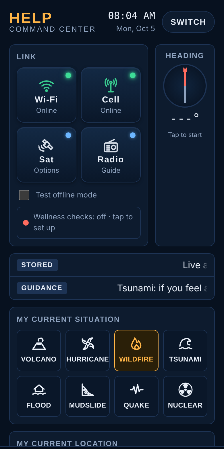
HELP Command Center, clock and date
Shows the current time and date on your phone.
Switch
Changes to the Seek HELP Center page.
Wi-Fi and Cell
Show whether you are online through Wi-Fi or mobile data. Tap either one for a short summary of your connection and what HELP is doing about it.
Sat
Opens your satellite texting options for when there are no cell towers.
Radio
Explains how to hear official alerts on NOAA Weather Radio and local AM/FM stations.
Test offline mode
Practice switch. Tick it to see exactly what HELP shows with no signal. Untick it to go back to normal.
Wellness checks status line
Shows whether you're connected to HELP's check-in service, or a warning for your area. Tap it to open Wellness checks and privacy.
Heading (compass)
Tap once to start. The red needle points north and the number is the direction you're facing. On iPhone, allow Motion access when asked. If it says "No reading", move the phone in a figure 8.

Alerts and your current situation
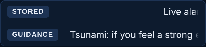
Weather alert ticker
Scrolls National Weather Service alerts for where you are. The tag on the left tells you how fresh: LIVE = received just now · SAVED = last alerts received, shown when you're offline · STORED = nothing saved yet
Guidance ticker
Short safety reminders stored on your phone, always available.
My current situation: eight hazard buttons
Tap the one that matches what's happening to you: Volcano, Hurricane, Wildfire, Tsunami, Flood, Mudslide, Quake (earthquake) or Nuclear. It lights up in amber and opens that hazard's Do now checklist.
Automatic selection
When you're connected to HELP and an official warning is issued for your area, HELP selects the matching hazard for you.
Location, street camera and map
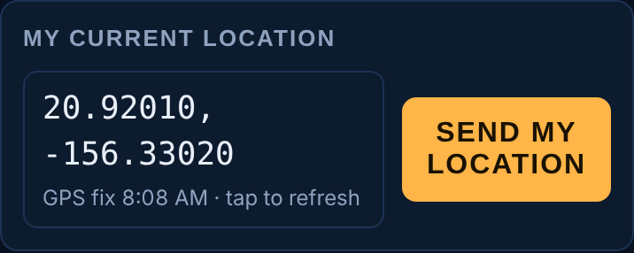
Coordinates
Your exact position as latitude and longitude. Tap to get a fresh GPS fix; the coordinates are also copied so you can paste them into a message. The line underneath says where they came from and when.
Send my location
Opens a ready-written text to your contacts with your coordinates.
Street cam
A live picture from the state traffic camera at the Kahului Airport OGG intersection, so you can see conditions in the center of town. It refreshes every 30 seconds with a LIVE tag. With no signal it keeps the last picture with a SAVED tag and its time. Tap it to open all Hawaii traffic cameras on GoAkamai.
Nearby help · works offline
A radar-style map with you in the center. Colored dots are shelter sites, hospitals, clinics, police and fire stations; rings show distance in miles. The dashed line points to the nearest shelter site, named underneath with its distance and direction. Once the compass is on, a shaded wedge shows which way you're facing and the line underneath says how far to turn. Tap the map to open Google Maps when you have signal.
Bottom bar
The bar along the bottom of the Command Center is always within reach of your thumb.
Do now
Opens the checklist for the hazard you've selected.
Shelter
Opens Nearest help, showing the closest shelter sites first.
Talk
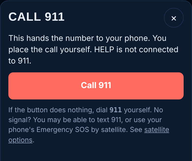
Opens Talk to someone now: spoken guidance, a Good-Neighbor volunteer, or 911.
Call 911
Opens a screen with a Call 911 button that hands the number to your phone's dialer. You place the call yourself.
My info
Opens My information.